
When you hear a weather forecast talk about a “cold front approaching” or a “warm front passing through,” you’re hearing about one of the fundamental drivers of day-to-day weather change. Weather fronts are invisible boundaries in the atmosphere — zones where two different air masses meet but don’t mix. Understanding what happens at these boundaries explains why the weather can swing from sunny to stormy within hours.
What Is an Air Mass?
To understand fronts, you first need to understand air masses. An air mass is a huge body of air — sometimes hundreds or thousands of miles across — that has relatively uniform temperature and humidity characteristics.
Air masses form over source regions. Continental polar air masses originate over cold land like Siberia or northern Canada. Maritime tropical air masses form over warm oceans like the Caribbean or the Gulf Stream. When this air moves, it carries its properties with it.
The UK sits at a latitude where several different air masses frequently collide. Arctic air from the north, continental air from Europe, maritime air from the Atlantic, and Mediterranean air from the south all contend for dominance. Where these different bodies of air meet, we get a front.
The Main Types of Fronts
Cold Front
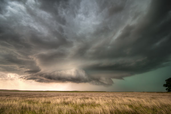
A cold front occurs when a cold air mass advances and displaces warmer air. Since cold air is denser, it pushes underneath the warm air, forcing it upwards rapidly. As the warm air rises, it cools, condenses, and forms clouds — often towering cumulonimbus clouds that produce heavy rain, thunderstorms, and gusty winds.
Cold fronts move quickly, typically 20–30 mph. The passage is usually abrupt: before the front, you have warm, unstable air. At the front, heavy precipitation and strong wind shifts. Behind the front, cooler, clearer, and often drier conditions.
For the UK, a classic cold front arriving from the Atlantic brings a sudden drop in temperature, a shift in wind direction (often to westerly or northerly), and a period of showery rain that clears to bright sunshine within hours.
Warm Front
A warm front forms when warm air advances into an area occupied by colder air. Unlike cold fronts, warm air is lighter, so it gently slides over the top of the cold air rather than pushing it aside. This gradual ascent creates a different cloud sequence: high cirrus clouds first, followed by thicker altostratus, then nimbostratus bringing steady, prolonged rainfall.
Warm fronts move more slowly than cold fronts — around 10–15 mph. The transition is gradual. The weather ahead of a warm front is often gloomy and overcast with light drizzle. At the front itself, rain may intensify briefly. Behind the front, temperatures rise noticeably, skies clear gradually, and humidity increases.
In winter, a warm front can be deceptive — bringing rain instead of snow despite the low temperatures, because the rising warm air melts snowflakes before they reach the ground.
Occluded Front
An occluded front forms when a cold front catches up with a warm front, lifting the warm air completely off the ground. This typically happens within a depression (low-pressure system) as it matures. The cold air behind the depression overtakes the warmer air ahead of it, and the boundary between them becomes complex.
Occluded fronts can bring mixed weather — a combination of the heavy rain and wind of a cold front with the prolonged, steady rainfall of a warm front. They’re common in British weather, especially as Atlantic depressions cross the UK and begin to fill.
Stationary Front
A stationary front forms when two air masses meet but neither is strong enough to displace the other. The boundary essentially sits in place, producing long periods of cloud and drizzle without significant temperature change. Eventually, one air mass strengthens or the jet stream shifts, causing the front to move again.
Stationary fronts can linger for days, particularly in spring and autumn. They’re responsible for some of the most frustrating weather — damp and grey but not quite stormy.
Reading the Signs
You can often tell when a front is approaching before the forecast confirms it. Several clues give it away:
- Barometric pressure drops steadily as a front approaches, stabilises at the front, then rises behind it
- Cloud patterns change — cirrus → cirrostratus → altostratus → nimbostratus for warm fronts; cumulus → cumulonimbus for cold fronts
- Wind direction shifts — typically clockwise in the Northern Hemisphere as fronts pass
- Temperature trends — warming before a warm front, cooling after a cold front
The traditional proverb “Red sky at night, shepherd’s delight” actually relates to frontal systems. A red sky at sunset in the west means high pressure (and good weather) is approaching from that direction. Conversely, “Red sky in morning, shepherd’s warning” means the high pressure has passed, and a front carrying poor weather is coming from the west.
Fronts on the Map
On weather charts, fronts are marked with symbols:
- Cold front: Blue line with triangles pointing in the direction of movement
- Warm front: Red line with semicircles pointing in the direction of movement
- Occluded front: Purple line with alternating triangles and semicircles
- Stationary front: Alternating blue triangles and red semicircles on opposite sides of the line
Meteorologists track these boundaries carefully because they determine the next few days’ weather. A front positioned over the Atlantic might mean a wet week for the UK, while a high-pressure ridge blocking its path could bring sunshine.
Why Fronts Matter for the UK
The UK’s reputation for changeable weather is fundamentally tied to fronts. Our location at the junction of polar and tropical air masses means we sit in the path of frequent frontal systems moving across the Atlantic.
Summer fronts tend to be more benign — warm fronts bringing gentle rain, cold fronts triggering afternoon thunderstorms. Winter fronts are more consequential, bringing periods of heavy rain that can lead to flooding, or occasionally snow when arctic air collides with moist maritime air.
Understanding fronts doesn’t just help you plan your weekend — it explains why forecasts often say “periods of rain with brighter spells” or “improving conditions later.” It’s the slow march of invisible boundaries in the sky, determining whether you’ll need an umbrella tomorrow.
Fronts Around Monkton Heathfield
For us here in Monkton Heathfield, weather fronts arrive from the Atlantic with predictable regularity. The valley of the River Tone — flowing eastward from Wellington through Taunton to the Bridgwater Levels — channels air movement in ways that local observers have noted for generations. A warm front rolling in from the west often brings persistent drizzle that settles into the low-lying Levels, while a cold front sweeping down from the Bristol Channel can clear skies rapidly but leaves frost pockets in the Tone valley on winter mornings.
The Quantock Hills to the west and the Blackdown Hills to the south create microclimates that affect how fronts pass through. Rainfall totals recorded at the West Monkton Cricket Ground station often differ from those in Taunton town centre by several millimetres, simply because hills force air upwards, enhancing precipitation on windward slopes while sheltering valleys behind. This local variation is why having a weather station in Monkton Heathfield itself provides such valuable hyper-local data — it captures exactly what this parish experiences, not what neighbouring parishes feel.
Spring and autumn see the most varied frontal activity as air masses from all directions compete for dominance. Summer fronts can trigger intense afternoon thunderstorms when warm, humid air rises rapidly over heated land. Winter fronts deliver the rain that keeps our wells and watercourses replenished, though when arctic air pushes far enough south, we can see snow squalls as cold maritime air crosses the Bristol Channel and dumps its moisture on the Somerset Levels.
Understanding fronts doesn’t just help you plan your weekend — it explains why forecasts often say “periods of rain with brighter spells” or “improving conditions later.” It’s the slow march of invisible boundaries in the sky, determining whether you’ll need an umbrella tomorrow.